Scoop Photos! Kariya Castle Maps Discovered
Hand painted maps dated 1670 and showing defence upgrades found!

During the Edo period, because of the Ichi Koku Ichi jo Rei, a law enacted by the Tokugawa bakufu allowing only one castle per domain, many castles were abandoned and demolished leaving some 170 castles in operation across Japan.
The new laws also forbid rebuilding, altering, enhancing or even repairing castle structures and features without the explicit permission of the bakufu. The law also required the daimyo supply maps and diagrams of all aspects of the castle and structures including keeps, turrets, gates and even the residential and administrative buildings. For that reason, details regarding many Edo period operative castles remain, however, many are very simple reports. Detailed maps showing major renovations and changes are rare, particularly the maps shown for the first time ever, here!
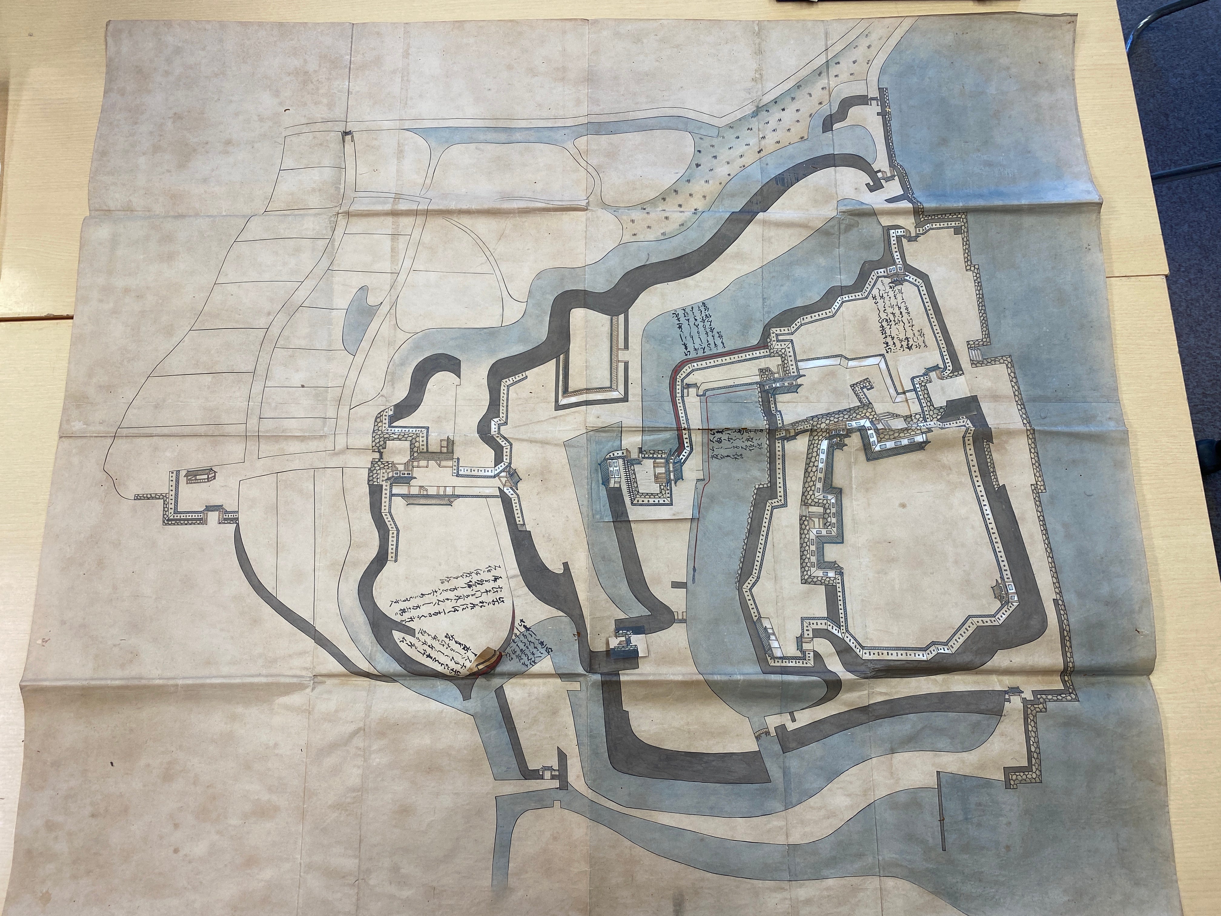
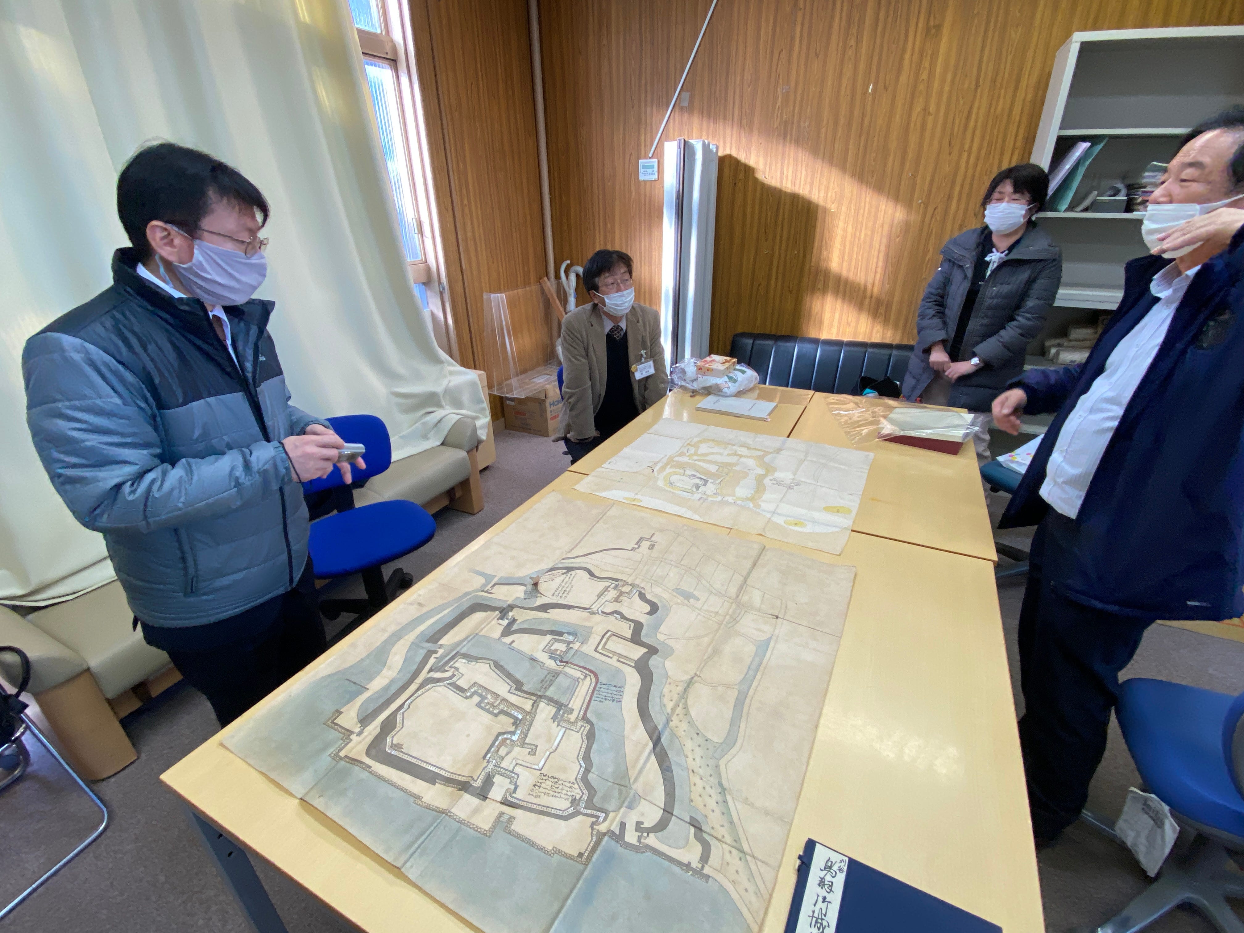
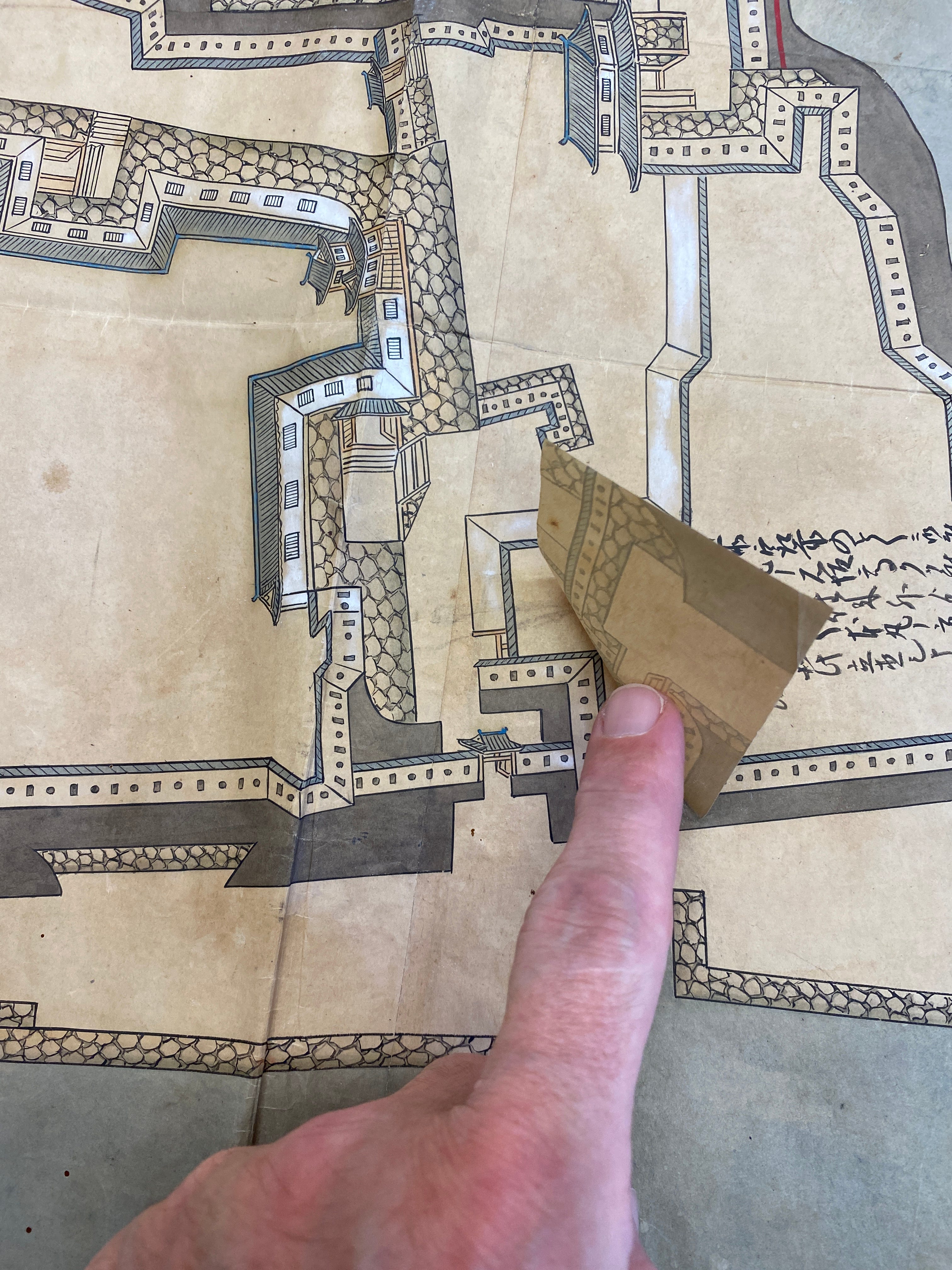
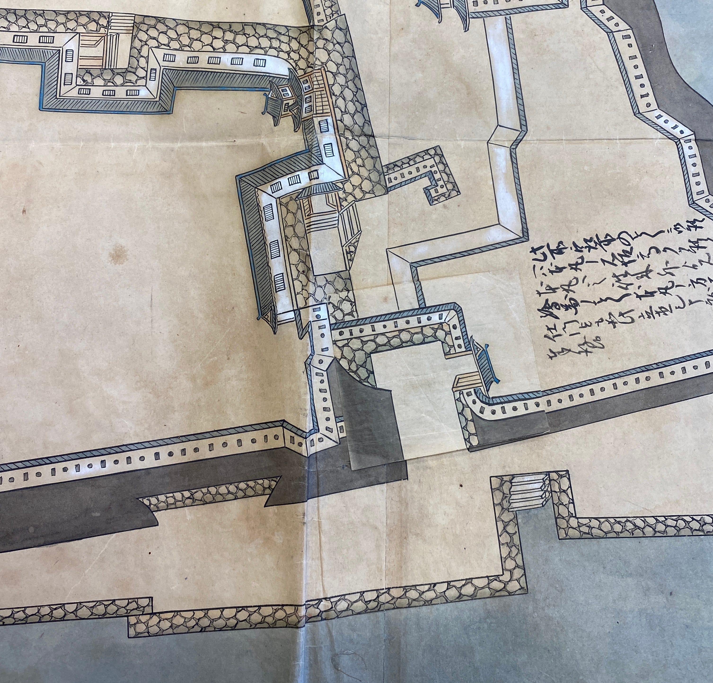
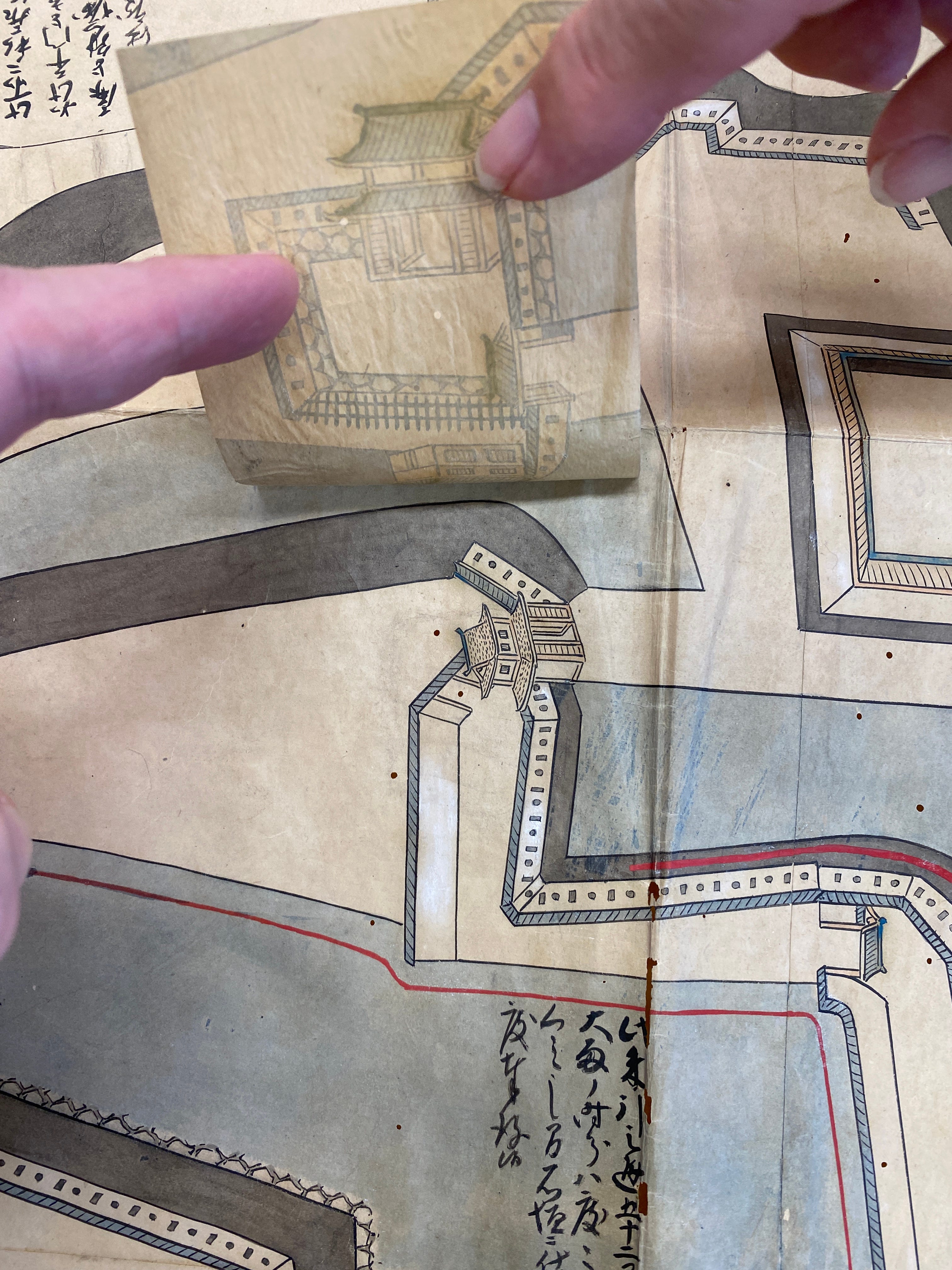
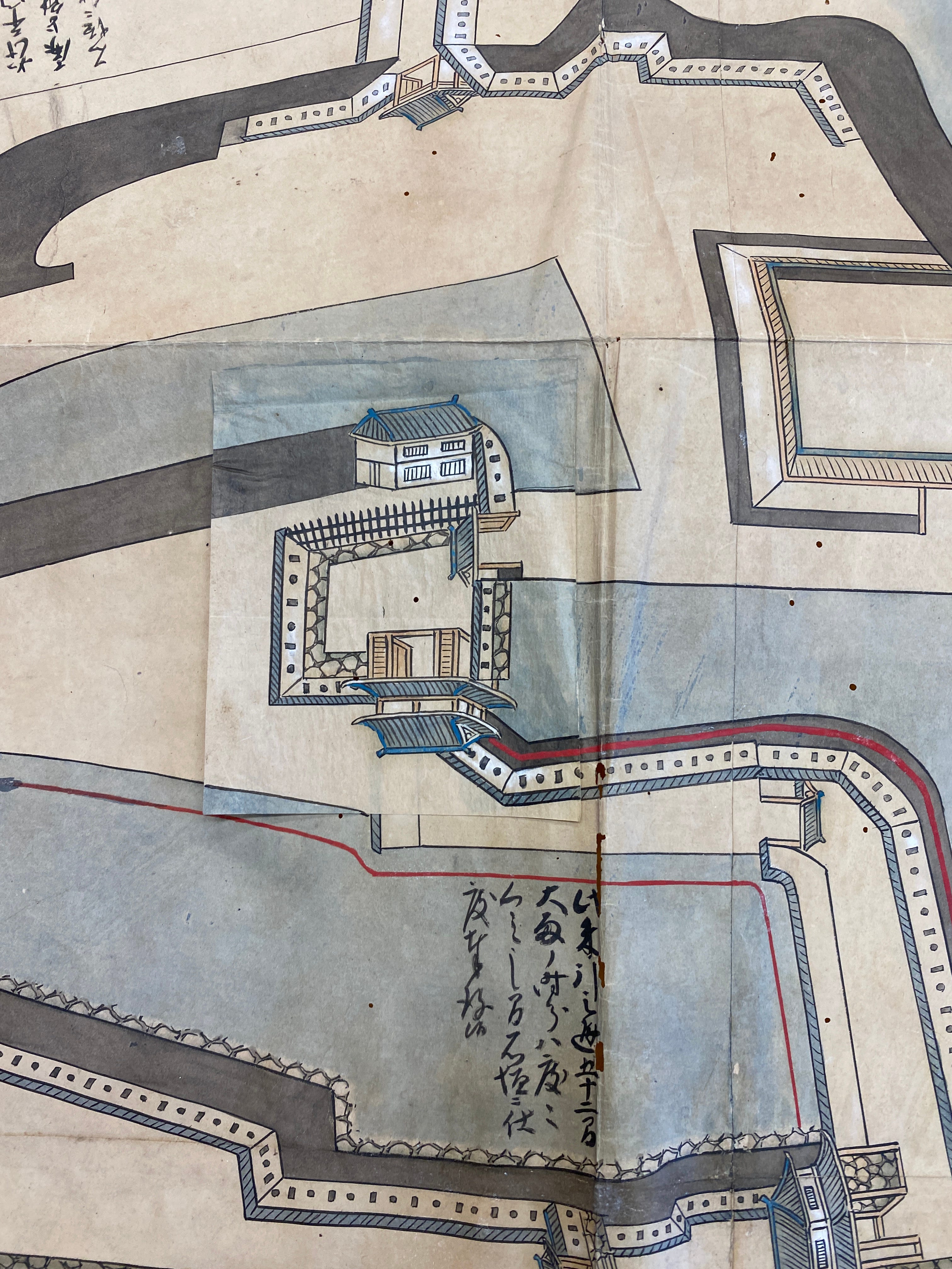
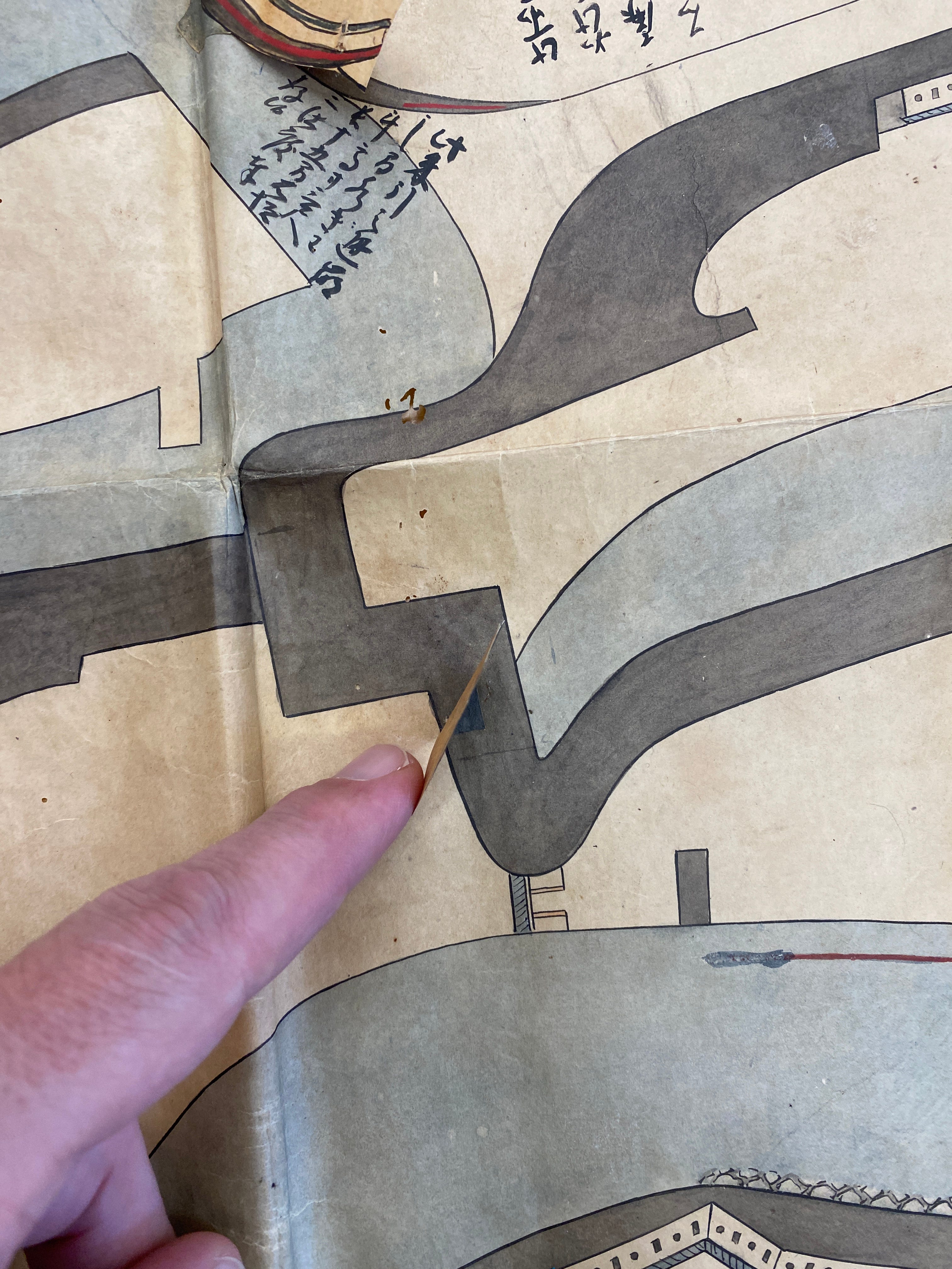
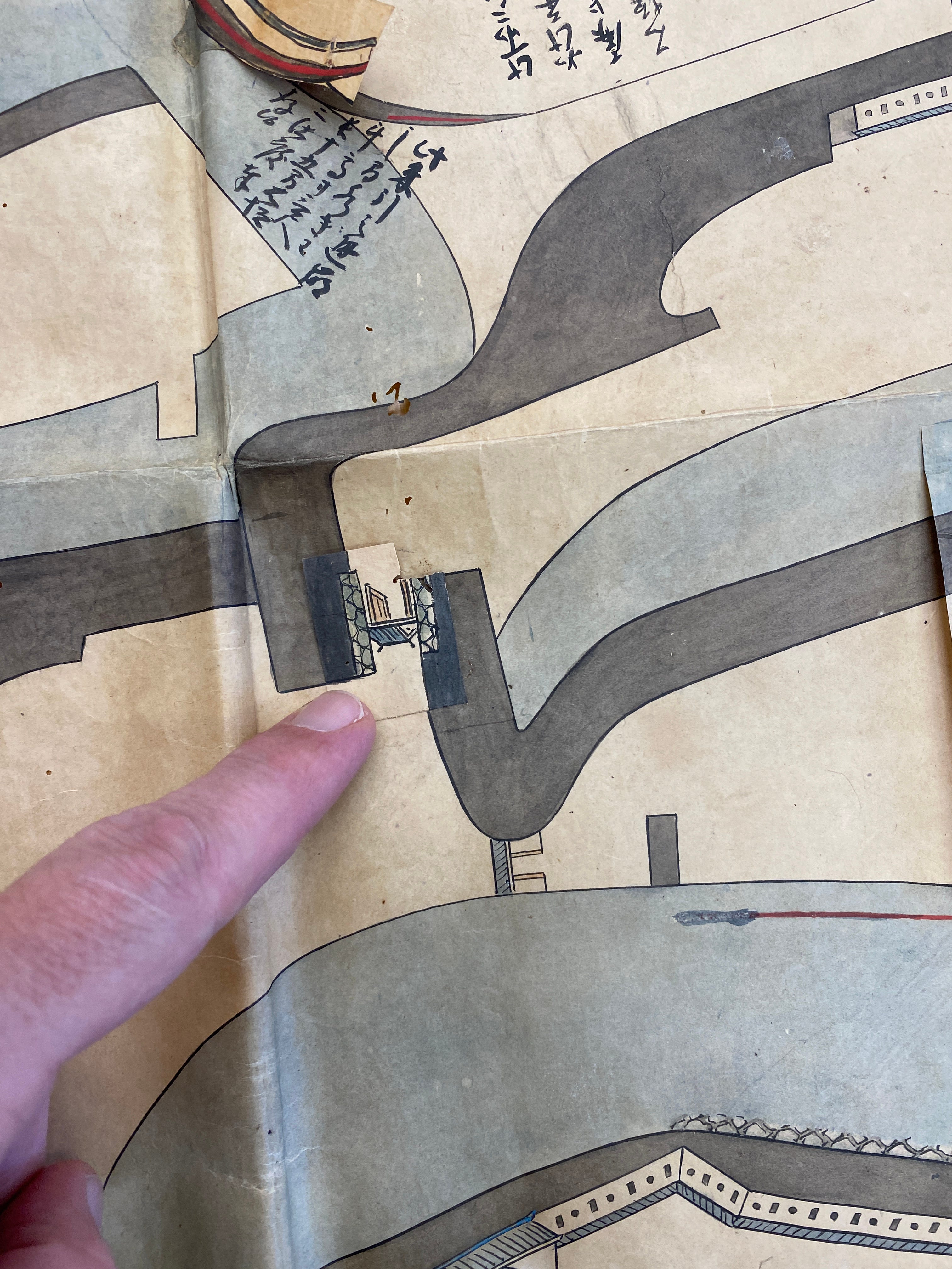
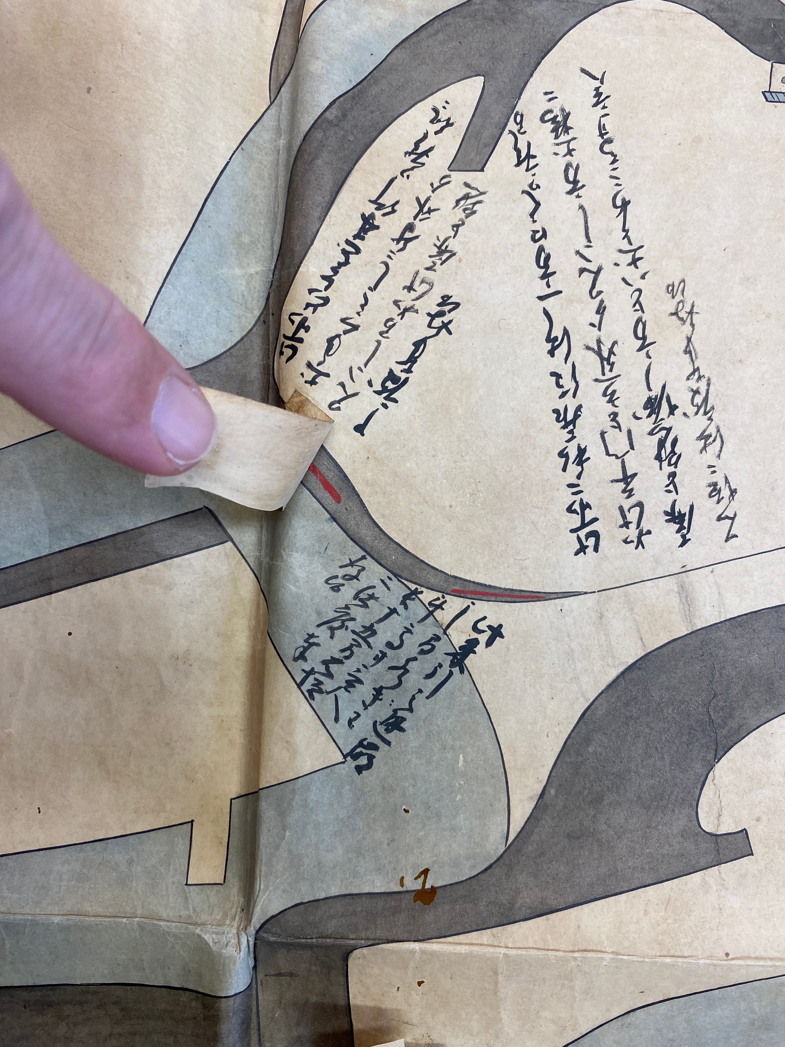
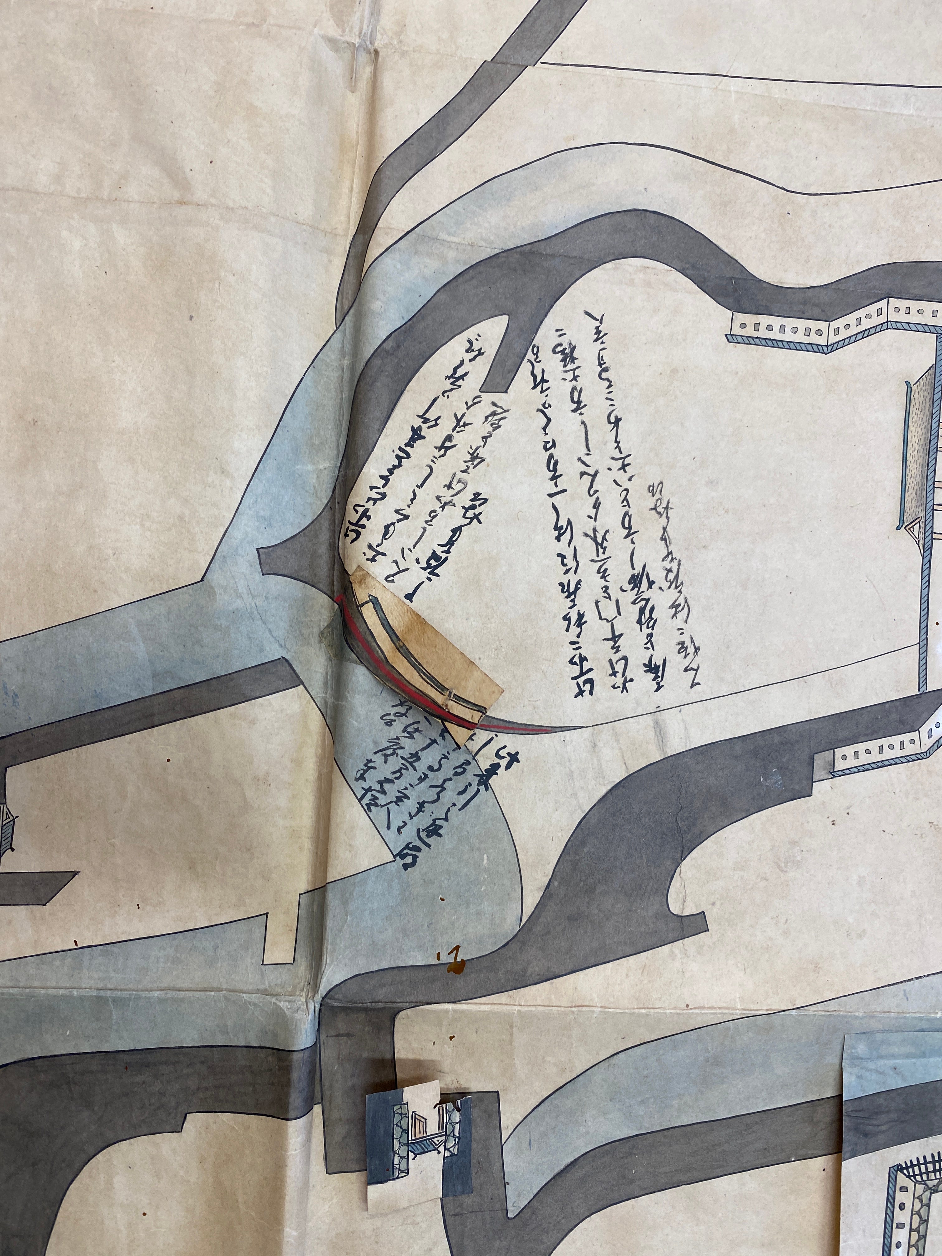
These photos are of a recently discovered large-scale hand drawn map painted on thick, strong traditional washi paper. Dated 1670, the map shows the restructuring of various defences within Kariya Castle, with the original design painted first and the upgrades superimposed on flaps of paper pasted on top. With the current owners’ permission, these photos were taken and can now be explained. First though, let’s have a look some information on Kariya Castle.
Kariya Castle
Modern day Kariya City in Aichi Prefecture is a quiet town, but during the Warring States period it was a centre of war and political intrigue. The Kariya domain was the territory of the Mizuno clan, Tokugawa Ieyasu’s mother’s clan. Ieyasu's maternal grandfather, Mizuno Tadamasa, built Kariya Castle around 1533, when Ieyasu's mother was six years old. Because of its location in Kariya, the Mizuno clan diplomatically attempted to balance the threat of the Imagawa, Matsudaira and Oda clans.
Ieyasu's mother, Oda no Kata, married Matsudaira Hirotada in 1541, and two years later their son Takechiyo, the future Tokugawa Ieyasu, was born. The Mizuno betrayed the Matsudaira family in 1544, so Hirotada divorced his wife and she remarried to Hisamatsu Toshikatsu, lord of Sakaba Castle, and they had three sons and four daughters together.
The Mizuno clan formed an alliance with Oda Nobunaga and served Toyotomi Hideyoshi after Nobunaga's death. Toyotomi Hideyoshi ordered the Mizuno clan’s transfer to Ise Province. After Sekigahara, Ieyasu had his cousins relocated back to their ancestral homeland, after which Kariya Castle was placed under the command of the Matsudaira, Inagaki, Abe, Honda, Miura and Doi clans. The earthworks were later covered by high mud walls, and around the main gate were the Masugata mon gate and the Tamon turret.


(Above; Kariya Castle model display in Kariya City. Photos © 2020 Chris Glenn)
The collapse of the shogunate in 1868 saw the closure and demolition of Kariya Castle in 1871.
There is remaining evidence that Miyamoto Musashi served under the Mizuno clan of Kariya Castle during the Osaka campaign of 1614 and 1615. After Osaka, Musashi is said to have adopted Miyamoto Mikinosuke, the third son of Nakagawa Shimanosuke, a vassal of the Mizuno clan as his son.
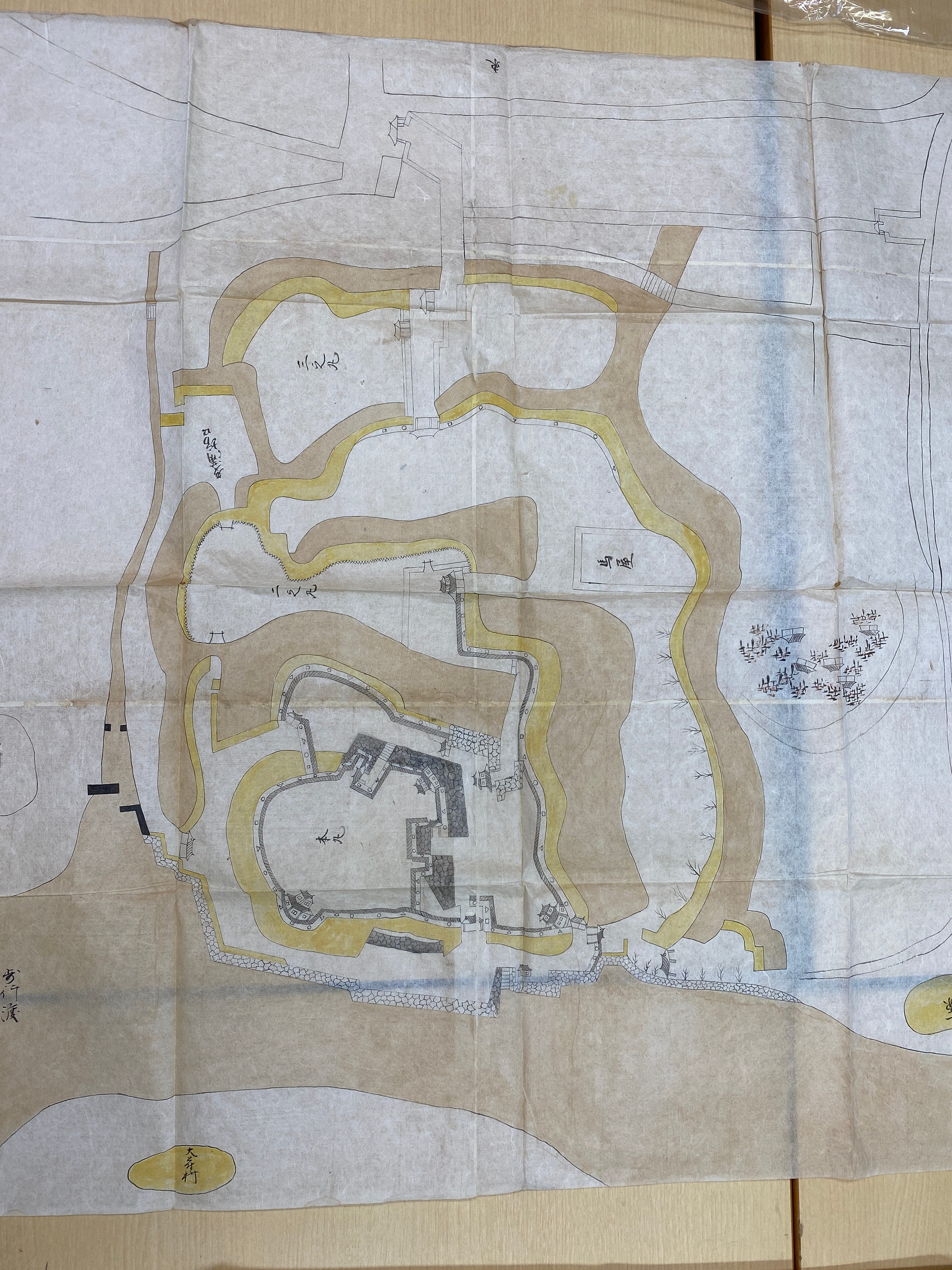
Kariya Castle's main compounds were carved from the banks of two rivers, the Sakai River and the Aizuma River, with the main Honmaru and the Ni-no-maru baileys forming an island. Surrounded by high dorui, earthen embankments, Kariya Castle is not square like most castles, but elongated and rounded. With its four earthen bridges leading to the Honmaru and Ni-no-maru, Kariya Castle must have looked like a giant tortoise, and so another name for Kariya Castle was Kame Jo, Turtle Castle.
Over the years, Kariya Castle changed as castle construction and technology developed, moving from the medieval period when it was built by the Mizuno family into the early modern period, and so we can see a mixture of castle construction techniques being utilized.
Around the main entrance and exit gates of Kariya Castle were tamon yagura turrets. The tamon turret was a very powerful defensive feature of the castle. These tamon turrets were long corridor-like structures, averaging about 4 m high and 6 m wide. They were used to store weapons, armour and even supplies. During an attack, however, the defenders could move around inside the corridors of these tamon turrets, unseen by the attacking enemy. Being inside the tamon meant that the defenders were protected from the elements of rain, wind and sun. Not only were the defenders protected from the weather, but also their weapons. The surrounding attackers, on the other hand, were exposed to the elements, and to the defenders, who could easily see the invaders from special protective latticed windows along the length of the tamon turret. The gate of the turret was also surrounded by a tamon turret, providing added protection for the castle.
There was a stone wall were built around the main gate. In front of it was a small koraimon, and beyond it was the strong, square impassable masugata-mon gate system, surrounded by walls and turret gates.
The Tatsumi turret was a double story turret standing in the south-eastern corner. Tamon turrets were connected on both sides. This was used as the main gate of Kariya Castle. In the Meiji era (1868-1912), the Tatsumi turret of Kariya Castle was dismantled, sold and moved to Myofukuji Temple where it remains as the temple’s tower gate, but it appears to have undergone significant changes over time, as it is barely recognizable as a castle watchtower.
The Honmaru’s east gate, also known as the rear gate, was crossed from the Tatsumi turret by a tamon turret. Its gateway was 5.4 metres long, quite big for the times and the size of Kariya!
In the north-west corner of the main circle, where the Juho-tei community center is now located, stood a double, or possibly triple story, small keep-like structure, measuring 7.2 x 9 metres on the ground floor and 5.4 x 7.2 metres on the second floor. Inugai Turret like a small keep
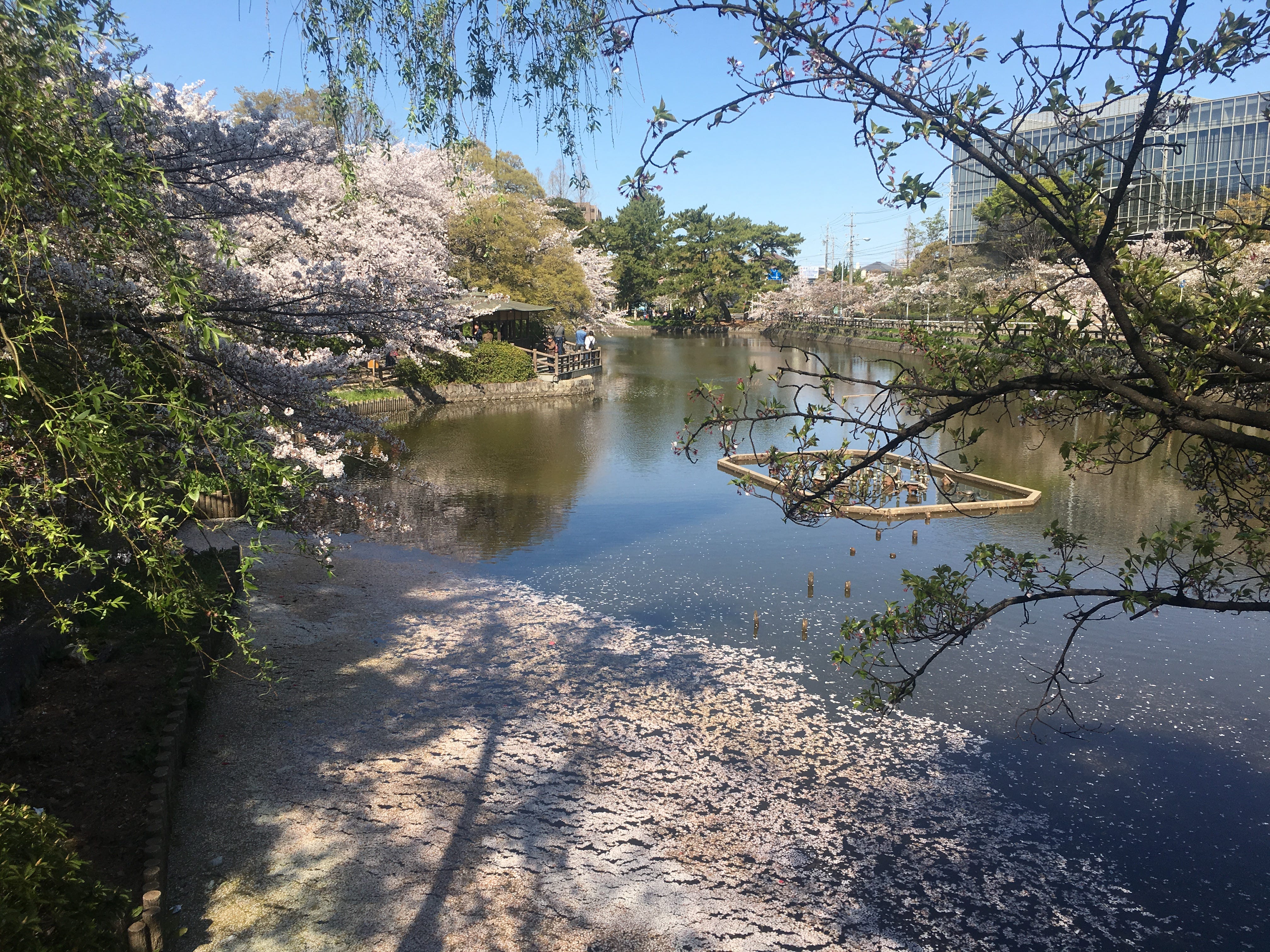
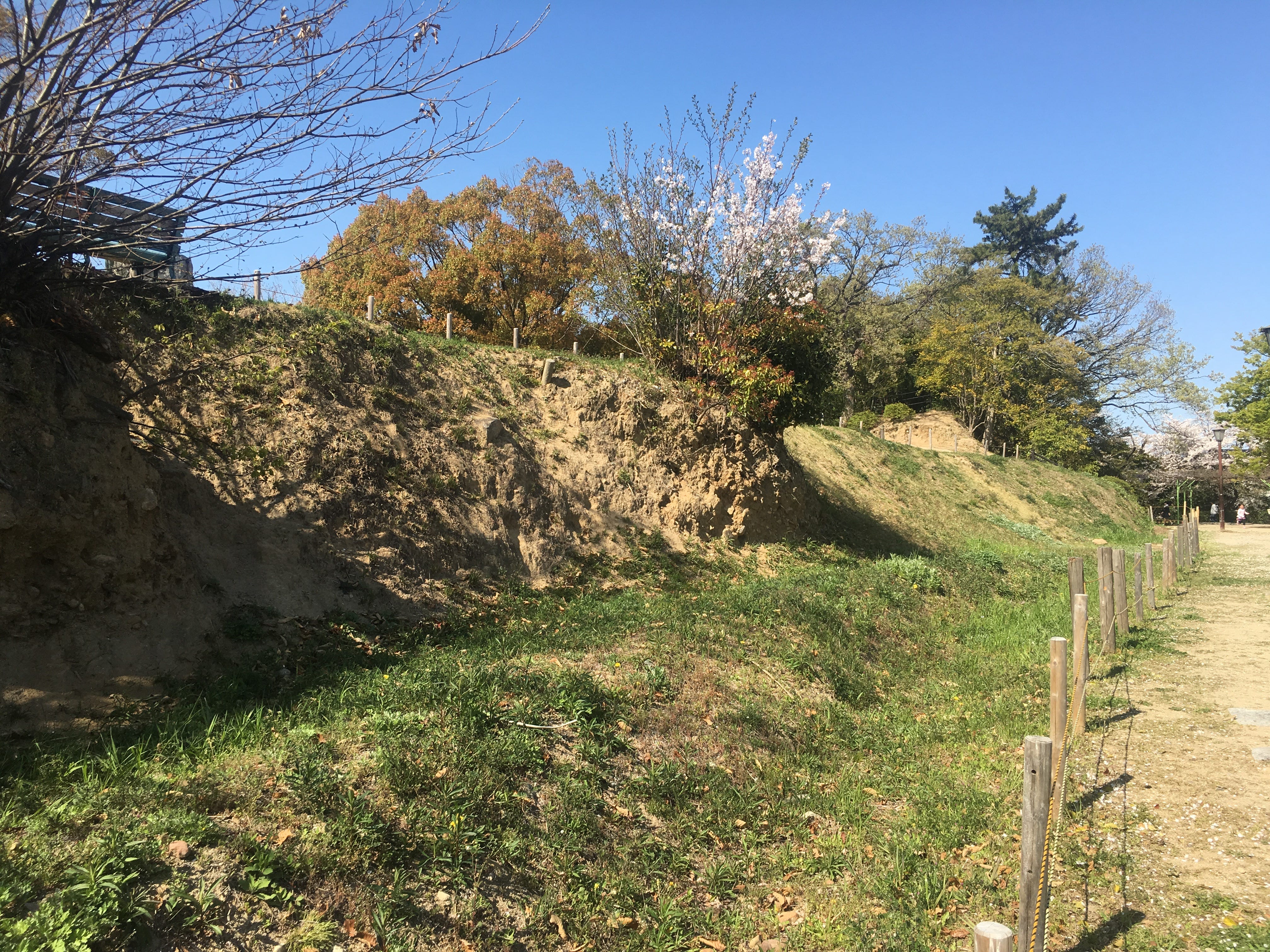
The ruins of Kariya Castle are now a suburban park, retaining some of the castle's features such as its wards, earthworks and water moat. Interestingly, the high, wide dorui earthworks can still be found encircling the main Honmaru.
About six years ago, Kariya City announced plans to rebuild parts of Kariya Castle in an authentic way. This is something to look forward to when it becomes a reality. Because Kariya Castle is an important historical castle, mixing medieval and modern times. The discovery of these maps, which have also been made available to Kariya City to examine, could mean that plans may be sped up, as these maps, produced for the shogunate, add a great deal of insight and validation.
Let’s have a look in detail at the main map now.
While these maps answer many questions about Kariya Castle’s layout and defences, it also raises many other questions. The next major questions are; why Kariya Castle’s lords wanted to upgrade and strengthen the castle, and why the shogunate, normally very strict regarding such large scale upgrades, would permit it? Japan had been under Tokugawa rule and at peace for around 70 years. The last major battles, the Siege of Osaka had cemented that peace in 1614 and finally in 1615. Apart from the Battle Shimabara in Nagasaki (late 1637- mid 1638) there had been no warfare. Castles had taken on an administrative role rather than a military one. Could it have been that the shogunate ordered such changes to increase spending within the flourishing Kariya domain? Or was there a concern of dissent from neighbouring fiefs, and the potential for turmoil prompted the changes? The maps are now being examined, and may shed further light on this fine fortress.