


Touring the Sekigahara Battlefield
Part 1 of What To See and Why

The Battle of Sekigahara was fought on October 21, 1600. It was the biggest, bloodiest field battle in samurai history, a fascinating battle to study, being quite complex politically in the lead up, involving much intrigue and behind the scenes manipulation before arriving at the actual seven hour battle itself.
The battlefields remain in very good condition, and are well signposted and mapped. Visiting Sekigahara is like visiting the birthplace of the Edo period and indeed, modern Japan! There’s so much to see, learn and enjoy, we’ll have to do this in parts,…here we go, いざ出陣!
Touring Sekigahara, Part 1.
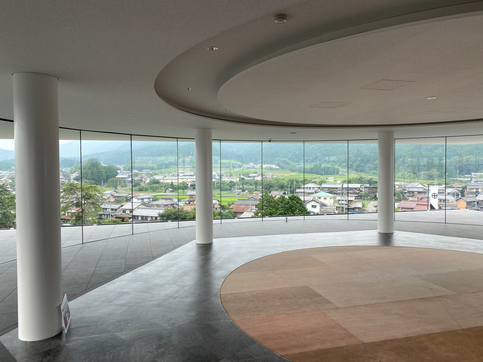
Start your tour at the new Sekigahara museum. Give yourself an hour or two to really experience it! It offers an interesting look at the battle, and arms, armor and relics from the past. Free guide maps and good info in english is available here too (I did all the English content) . The souvenir shop isn't bad either! Before you come, make sure you know all about the Battle of Sekigahara, by reading my non-fiction book, The Battle of Sekigahara, now available in paperback too,…much lighter than the hardback edition!

After visiting the Sekigahara museum, walk about 30 meters south to the corner of the park opposite. Here you’ll find the flags and a small stone memorial to Tanaka Yoshimasa. This is where Tanaka set his war-camp, pretty much central to the fighting that bloody day.
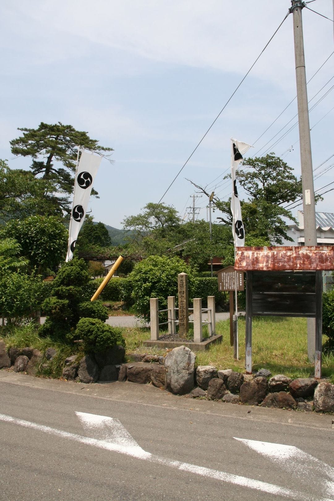
Tanaka had 3,000 men under him at Sekigahara, but at first he was reticent to fight. Although he had joined the eastern Forces under Tokugawa Ieyasu, it appears he was hoping that his friend, Ishida Mitsunari would win. As it was, at around 10 am on the day of the battle, he was forced to take action against the Western forces, and the reason for that is, Tokugawa Ieyasu relocated his command post from Mt. Momokubariyama, 2km east of the battlefield to this central position during the height of the battle.
After visiting the site of the Tanaka Yoshimasa’s command post, walk 30 meters west to the center of the park. For the last 424 years, this area has been known as Jinbanno, the War Camp Plain. This was the site where Tokugawa Ieyasu set his second and final command post during the battle. As mentioned, originally he had been situated some 2km east towards Tarui on Mt. Momokubari, however by about 10am, impatient that the battle was still far from over, he shifted his 30,000 troops and main camp to this central area, only 800 meters south of Ishida Mitsunari’s command post.
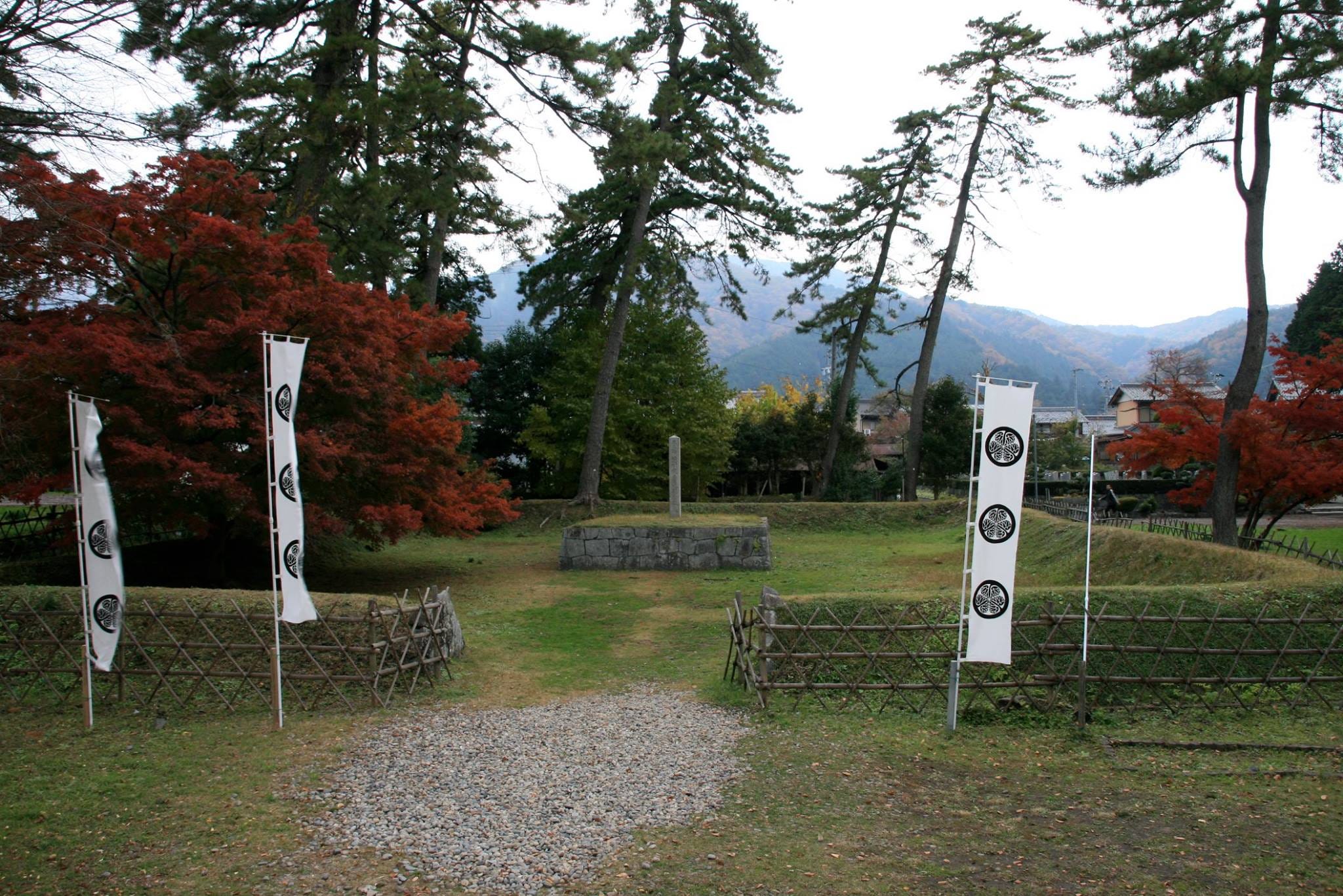
It was here on the adjacent grassed area that Ieyasu held the Kubi-jikken, the Head Viewing Ceremony, and the area east of this was where thousands of heads were collected and displayed before burial in the Kubi Zuka, or Head Mound. Take note of the tall, twisty pine trees surrounding Ieyasu’s encampment. These trees will help you locate the site later when we get to Ishida Mitsunari’s command post.
Having seen the site of Tokugawa Ieyasu’s command post, head north along the narrow road alongside the Sekigahara museum. A 10 minute walk, or 3 minute bike ride away is the site of Hosokawa Tadaoki’s war camp. Although the signs are often hard to see, and the lack of English here doesn’t help, the free maps available at the railway station and the museum are easy to understand, and have the battle flags of the leaders pinpointing the sites. In this case, located behind a pond with a small children’s playground is the most recently unveiled stone monument.
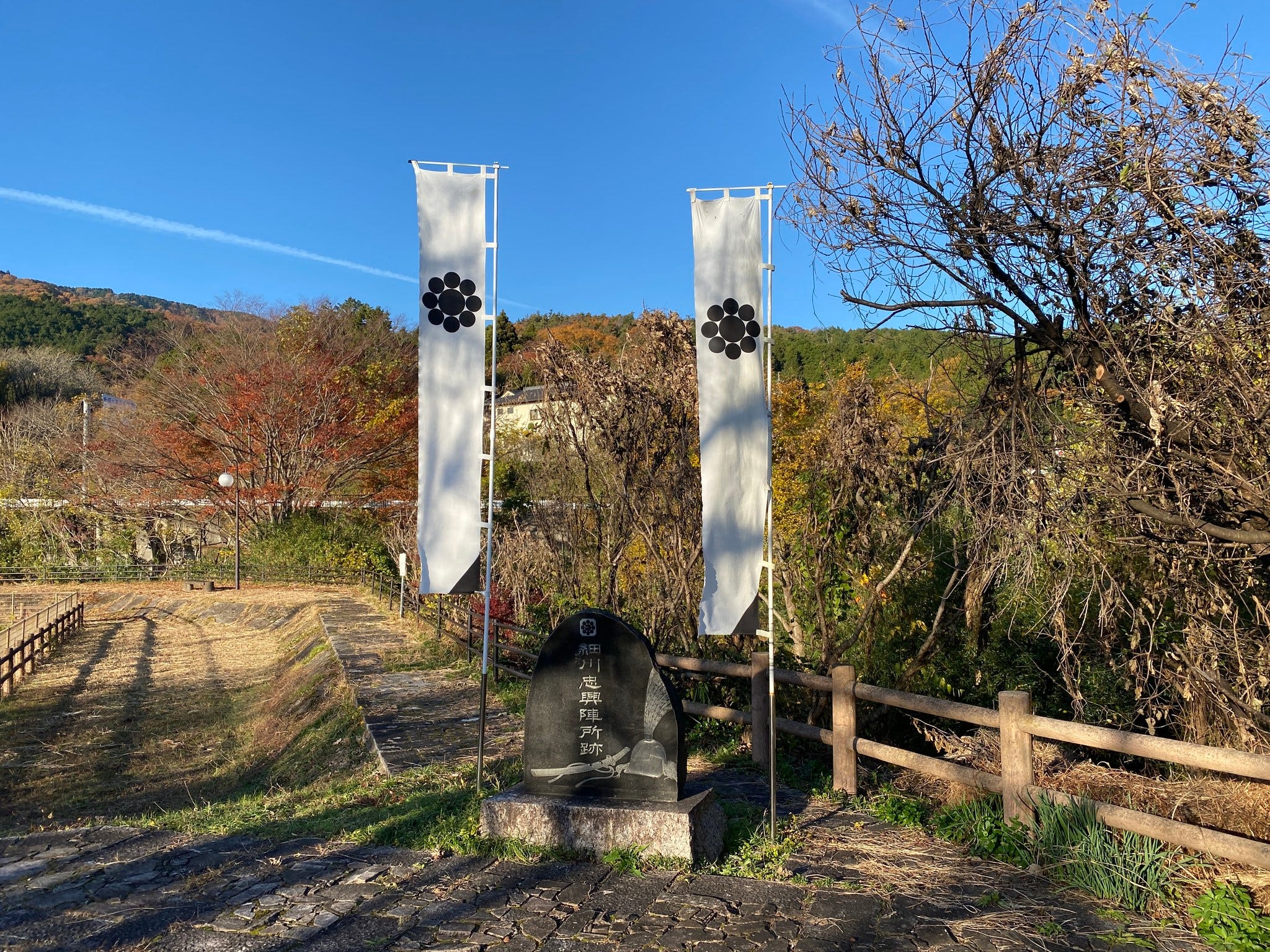
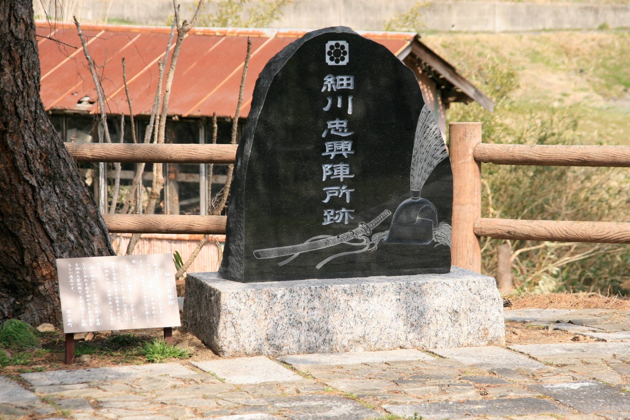
Erected in 2013, the first in over 100 years, the Hosokawa camp also has one of the most original stone markers, a large, black stone with Hosokawa’s famed swords and his distinctive helmet etched into it. Around here, Hosokawa set up his tent-like curtain command post, while his 5,000 troops prepared for battle. From the Hosokawa site, look north-east to the hills behind. The hill face bare of trees and with tall banner like flags flying above is our next destination, Kuroda Nagamasa and Takenaka Shigekado's command Post!
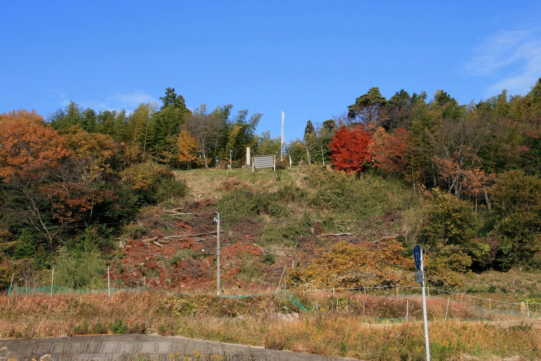
There is a small carpark with space for about 5 cars marked on the easy to follow maps available at the start of your trip if you’re driving or hiring a bike. There are signs warning you to be aware of bears and snakes. The signs fail to mention mosquitos and bees. Some of these mosquitoes are the size of a Robinson R22 helicopter! Come in summer and you’ll know what I mean!
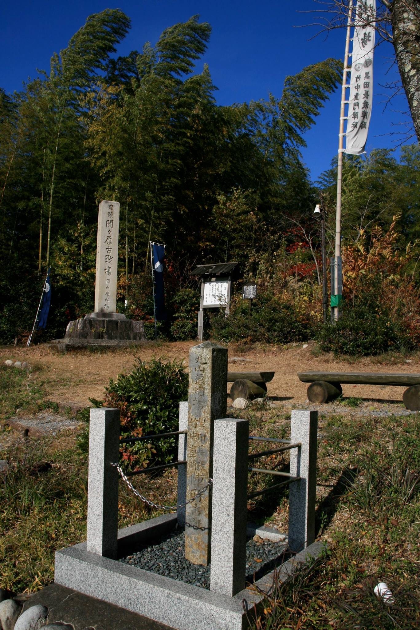
The site had been chosen by Takenaka Shigekado, the Lord of Tarui and the Sekigahara area. He had joined the Eastern Forces just the night before the great battle, and had offered his men and his services to Kuroda Nagamasa. Kuroda had brought some 5,200 men with him, and Takenaka just 200. These samurai covered the area directly below this small but steep hill, known as Okayama now, but back in the day, called Maruyama. From there they were directly, barely, 800m from Ishida Mitsunari's war camp, and within easy striking distance. They also had a fine view of the plain where the Eastern forces were strung out.
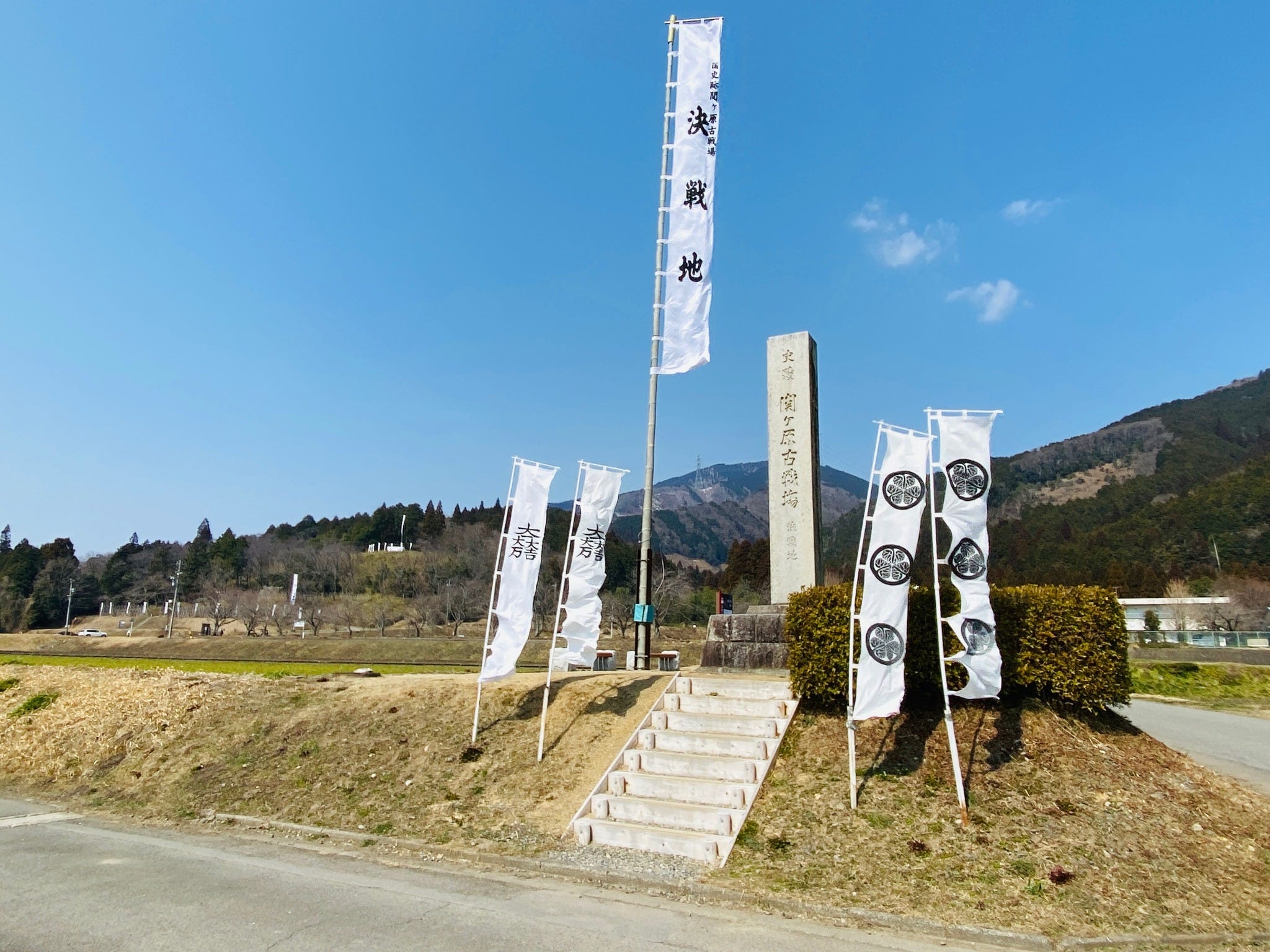
Having enjoyed the view from the Kuroda / Takenaka command post, it's time to head to the center of the battle field, and the site of the most ferocious, most bloody fighting of that fateful day in 1600. Situated in the middle of rice paddies that have barely changed in over 400 years, and not too far from Ishida Mitsunari's war camp on Mt. Sasao, is a large monument dedicated to those who fought and died at Sekigahara. The huge memorial stone is flanked by the battle-flags of the Tokugawa and the Ishida. This marks the site of the most fierce fighting of the day. If you’re walking or going by bike, you’ll notice that the land is sloping upwards, and this too must have slowed the Eastern forces as they advanced on the Western positions. The rice fields here remain pretty much as they were over 420 years ago.
We’ve reached posting limit here, so the next post will be part 2! Enjoy touring Sekigahara!
I visited the museum back in July. Those English translations were great! Thank you.